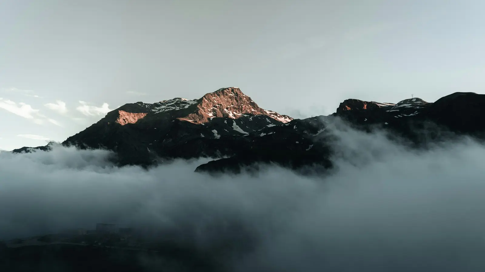
A mountain viewpoint can vanish into cloud while the coast or valley below remains sunny because the atmosphere changes with elevation. As moist air is pushed uphill, it expands, cools, and may reach the temperature at which water vapor condenses into cloud. The summit can then sit inside a moving cloud layer even when lower ground is bright and clear.
This is the central idea behind mountain clouds explained: visibility depends less on the weather icon for the nearest town than on the relationship between terrain, cloud-base height, wind, moisture, and viewpoint elevation. The same process helps explain the dramatic Madeira mountain weather that travelers can encounter between coastal roads, interior valleys, and high ridges.
Key Takeaways
- Air forced uphill by terrain expands and cools, often forming cloud when it reaches saturation.
- A clear coast or valley does not mean that a higher viewpoint will be clear; the summit may be at or above the cloud base.
- A cloud inversion can leave high ground above a lower cloud layer, while ordinary orographic cloud can envelop the ridge itself.
- Sunrise may improve the chance of seeing a cloud layer below a summit, but wind and moisture can still cover the viewpoint.
- Check forecasts for the actual elevation, including cloud base, wind, humidity or dew point, precipitation, and visibility.
How Air Rising Over a Mountain Creates Clouds
When wind encounters a mountain, it is forced to rise along the slope. This process, called orographic lift, reduces the pressure around the rising air. The air expands and cools as a result.
Air contains water vapor, although the amount varies. Cooling reduces the amount of vapor the air can hold. If the air cools to its dew point—the temperature at which it becomes saturated—some of that vapor condenses into tiny liquid droplets or, in colder conditions, ice particles. Those suspended particles form a cloud.
The mountain has not created moisture from nothing. It has lifted existing moist air high enough for condensation to occur. This is why a mountain can generate or intensify cloud even when nearby lowlands appear dry. The coast may remain below the condensation level while the summit reaches or exceeds it.
Several factors determine how strong this effect becomes. Wind direction matters because one slope may face incoming moist air while another lies in a drier or more sheltered zone. The available moisture, terrain height and steepness, and depth of the rising air all influence whether cloud forms.
These are orographic clouds: clouds associated with air being lifted by terrain. They may cling to a ridge, stream over a pass, or form and dissipate repeatedly as wind carries new air uphill. From a viewpoint, the change can seem sudden because a small shift in cloud height or wind direction may move the boundary across the summit.
Why Conditions Change So Much With Elevation
Temperature generally decreases with height in the lower atmosphere, but the rate is not fixed. It varies with pressure, moisture, air stability, cloud cover, and recent weather. A single rule about how many degrees the air loses per kilometer should not be treated as a universal mountain forecast.
Humidity is equally important. Relative humidity describes how close the air is to saturation at its current temperature. Dew point provides another useful clue: when air temperature and dew point are close, only a small amount of additional cooling may be needed for cloud or fog to form. A larger gap generally indicates more room for cooling, although terrain and incoming air can quickly change the picture.
At a high viewpoint, the air may be cooler and closer to saturation than it is below. If the predicted cloud base is near the viewpoint’s elevation, even a modest change in temperature, wind, or moisture can alter the view. A ridge that is visible one moment may disappear when cloud rises slightly, while a brief opening can reveal distant peaks before closing again.
Wind adds another source of rapid change. Stronger flow can push cloud across a ridge quickly, creating alternating periods of visibility and very poor visibility. It can also bring a new supply of moist air from an exposed slope. In other situations, calmer air allows moisture to remain pooled in valleys or basins.
This is why a coastal or valley forecast cannot stand in for a mountain forecast. A town may report sunshine, mild temperatures, and good visibility while the summit is colder, windier, and inside cloud. In Madeira, local terrain creates sharp differences between coastal areas, interior valleys, ridges, and high viewpoints. Conditions on one side of the island should not automatically be assumed to represent another elevation or exposure.
Cloud Inversion Versus Cloud Covering the Summit
A cloud inversion is often used to describe a scene in which a lower layer of cloud fills valleys while higher ground rises above it. The underlying meteorological feature is a temperature inversion: instead of cooling steadily with height, air becomes warmer above a cooler layer. This arrangement can restrict vertical mixing and help trap cool, moist air near the surface.
The visible result may resemble a white blanket below a summit. If the viewpoint stands above the cloud layer, the air around it can be relatively clear, allowing sunlight and distant peaks to appear above the clouds. This is the classic cloud inversion hiking experience.
That situation differs from ordinary summit cloud. With orographic cloud, moist air is being lifted over the terrain and condenses around the ridge or peak. The viewpoint is inside the cloud, not above a separate layer below it. Visibility may be poor even though valleys elsewhere are clear.
The distinction is useful but not absolute in practice. A temperature inversion can coexist with low cloud, and the cloud boundary can rise, sink, fragment, or spread as wind and sunlight change. A forecast may suggest conditions favorable for an inversion without predicting exactly where the visible top of the cloud will be or how long it will last.
A cloud layer below the summit is therefore a possibility, not a promise. If the cloud base is already above the viewpoint, the mountain may remain covered. If wind mixes the lower atmosphere, the inversion may weaken. If additional moisture arrives, the cloud layer may thicken rather than clear.
Why Sunrise Can Help—or Fail—to Reveal the View
Sunrise is sometimes a favorable time to look for a cloud layer below a mountain viewpoint because the ground and lower atmosphere have cooled overnight. In sheltered valleys and basins, that cooling can encourage moist air to remain near the surface. Winds may also be weaker before daytime heating changes local circulation.
Those conditions can leave low cloud pooled below higher ground at dawn. Early light then illuminates the top of the cloud layer, making the separation between valley and summit especially visible. This is one reason sunrise photographs can give the impression that morning automatically produces an inversion.
But sunrise does not control the cloud base. Strong winds can move cloud across the summit overnight or during the morning. Moist air may arrive from the sea, the cloud layer may already be higher than the viewpoint, or the atmosphere may be too mixed for a clear boundary to form.
Light can also improve the appearance of a scene without improving visibility. Low-angle sunlight may add contrast to ridges and cloud edges, but it cannot reveal a summit enclosed by dense cloud. Treat sunrise as a timing option that may improve the odds in some weather patterns, not as a reliable way to create a view.
How to Read a Mountain Visibility Forecast
The most useful mountain visibility forecast is one that describes the actual elevation or ridge rather than only the nearest town. Start by identifying the viewpoint’s height and comparing it with the forecast cloud-base height. If the cloud base is well below the viewpoint, the summit may stand above the layer. If it is near or above the viewpoint, cloud-related visibility problems become more likely.
Both figures are estimates. Mountain terrain is complex, and forecast models cannot represent every ridge, gully, slope, or local airflow in detail. A predicted cloud base should be treated as a zone of uncertainty rather than a sharp horizontal line.
Next, examine wind direction and speed. Wind approaching an exposed slope can support orographic lift and push cloud over the ridge. Strong flow also means that conditions may change quickly, even if a short-term forecast appears broadly favorable. The sheltered side of a mountain may behave differently from the windward side.
Humidity and dew point add context. High humidity or a small temperature–dew-point gap suggests that modest cooling may produce cloud, but those indicators should be read alongside temperature and terrain. Precipitation matters too: rain, drizzle, or showers can reduce visibility and make a cloud-covered route more consequential than a merely disappointing view.
Do not rely on a single clear-weather icon. Compare several forecast periods and, where available, use observations from a nearby high-elevation station or mountain-weather service. Look for agreement about cloud, wind, precipitation, and visibility rather than expecting exact timing.
A practical decision guide is:
- Wait when cloud is visibly moving, the cloud base appears close to but above the viewpoint, and wind, precipitation, and route conditions are otherwise safe. A temporary opening may develop, but there is no guarantee.
- Move lower when the summit is covered but nearby lower slopes or valleys offer a safer alternative. A lower viewpoint may sit beneath the cloud base, although it may also be surrounded by fog.
- Abandon the viewpoint when strong wind, lightning, heavy rain, ice, unstable conditions, or very poor visibility create a safety concern. A scenic objective is not worth treating a changing forecast as a certainty.
Waiting is most useful when conditions are marginal and safe, not when it means remaining exposed to deteriorating weather. In steep terrain, navigation and route conditions can become more important than whether the view might eventually open.
FAQ: Mountain Clouds and Viewpoint Visibility
Why can the coast be clear while a mountain summit is in cloud?
The coast is at a lower elevation and may remain below the condensation level. Air forced upward over the mountain cools and can form cloud around the summit, while the lower air remains clear. The summit may also be inside a separate cloud layer that does not extend down to the coast.
Are cloud inversions predictable for hiking?
Forecasts can identify patterns that may favor a cloud inversion, such as cool, moist air trapped below a warmer layer. They cannot guarantee the height, persistence, thickness, or visual quality of the cloud. Wind and incoming moisture can change the arrangement quickly.
What is the best forecast information for a mountain viewpoint?
Use the viewpoint elevation, cloud-base height, wind direction and speed, humidity or dew point, precipitation, and visibility together. Prefer information for the mountain or ridge itself over a general coastal forecast, and treat every value as an estimate in complex terrain.
Mountain clouds are not simply random obstacles. They are visible evidence of air being lifted, cooled, mixed, and redistributed across uneven terrain. Understanding that process makes a missed view less mysterious—and helps travelers choose a better time, a lower alternative, or a safe decision to turn back.