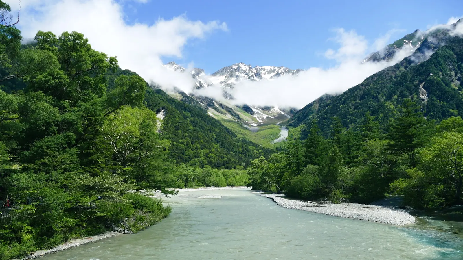
The dramatic landscapes of the Japanese Alps, Nikko’s plunging waterfalls, and the iconic cone of Mount Fuji all owe their existence to the same restless engine: the collision and subduction of tectonic plates beneath Japan. The geology of the Japanese Alps, Nikko, and Mount Fuji tells a story of compression, volcanic dams, and repeated eruptions that spans millions of years.
Key Takeaways
- The Japanese Alps were pushed up by tectonic plate compression 2 to 5 million years ago, forming steep granite ridges.
- Nikko’s waterfalls, including Kegon Falls, were created when ancient lava flows dammed rivers, forming lakes that later spilled over hard volcanic rock.
- Mount Fuji is an active stratovolcano built from repeated eruptions at a triple junction of tectonic plates.
- Travelers can see evidence of these processes: glacial valleys in the Alps, volcanic ash plains in Nikko, and lava fields around Fuji.
- The region’s rock types vary distinctly: granite in the Alps, basalt and andesite in Nikko and Fuji.
1. Japan’s Tectonic Setting: A Collision of Four Plates
Japan sits at a rare and volatile intersection of four tectonic plates: the Pacific Plate, the Philippine Sea Plate, the Okhotsk Plate, and the Amurian Plate. The Pacific Plate dives beneath the Okhotsk Plate along the Japan Trench, a process called subduction. This sinking plate carries water and sediments deep into the mantle, where heat and pressure trigger melting. The resulting magma rises, feeding the volcanic arc that forms the backbone of Honshu.
To the south, the Philippine Sea Plate subducts under the Amurian Plate, contributing to the formation of the Southern Alps and Mount Fuji. This constant movement—plates grinding and sliding at rates of several centimeters per year—provides the energy for the mountain building and volcanic activity that travelers witness today. The geology of the Japanese Alps and Nikko region is a textbook example of how plate tectonics sculpts a landscape.
2. The Birth of the Japanese Alps: Uplift by Compression
The Japanese Alps are not a single range but three: the Hida (Northern), Kiso (Central), and Akaishi (Southern) mountains. The Northern Alps, including peaks like Mt. Yarigatake and Mt. Okuhotaka, formed between 2 and 5 million years ago during the Pliocene epoch. Compression between the Okhotsk and Amurian plates created a thrust fault from the east, forcing the earth’s crust upward. This process lifted ancient seafloor sediments and granite plutons into steep, 3000-meter-high ridges.
Granite dominates the core of the Northern Alps. These rocks originated as molten magma deep underground. As the overlying crust eroded over millions of years, the granite was exposed, creating the rugged, light-colored peaks visible today. During the ice ages, glaciers carved U-shaped valleys and cirques in the range. The Kamikochi valley is a prime example: its flat floor and steep walls are classic glacial landforms. Hikers there can also see moraines and polished rock surfaces left by retreating ice. The contrast between the sharp granite ridges and the softer sedimentary rocks in lower valleys highlights the multiple forces that have shaped how the Japanese Alps formed.
3. Nikko’s Volcanic Legacy: Waterfalls from Lava Dams
Nikko National Park lies within the Nasu volcanic zone, an area still marked by geothermal activity in the form of hot springs and fumaroles. The standout feature of Nikko’s geology is Lake Chuzenji and its outlet, Kegon Falls. Thousands of years ago, a volcanic eruption of Mt. Nantai spewed lava that flowed into a river valley. When the lava cooled, it formed a natural dam, impounding water that became Lake Chuzenji. Eventually, the lake overflowed, cutting through the lava dam to create Kegon Falls—a 97-meter cascade over hard volcanic rock.
Other waterfalls in Nikko, such as Yudaki and Ryuzu, also resulted from volcanic topography. The Senjogahara marshland formed on a flat plateau of volcanic ash and pumice, where drainage is poor. The rock types here are basalt and andesite, dark volcanic rocks that contrast sharply with the granite of the Alps. Visitors can see steam rising from vents near Yumoto Onsen and smell sulfur in the air—direct evidence that the underlying magma system is still active. The Nikko geology and waterfalls are thus a direct product of volcanic activity, not merely erosion.
4. Mount Fuji: A Stratovolcano Built by Repeated Eruptions
Mount Fuji sits near the triple junction of the Amurian, Philippine Sea, and Okhotsk plates. Subduction of the Philippine Sea Plate releases water into the mantle, lowering the melting point of rock and generating basaltic magma. Over the last 100,000 years, repeated eruptions have built the classic symmetrical cone that defines Fuji today. Unlike the granitic Alps, Fuji is made of interlayered basalt lava, ash, and pumice—the hallmark of a stratovolcano.
Fuji’s last major eruption occurred in the early 1700s (the Hoei eruption), covering Edo (modern Tokyo) with ash. Although currently dormant, monitoring networks track its status as an active volcano. The tectonic origin of Mount Fuji is rooted in the subduction of the Philippine Sea Plate, which continues to supply magma beneath the mountain. Travelers visiting the Fuji Five Lakes region see direct evidence of past lava flows: the lakes themselves formed when lava blocked rivers, and the Aokigahara Forest grows on a rugged lava field with numerous caves and vents.
5. Seeing Geology on the Road Trip: A Traveler’s Guide
A road trip connecting the Japanese Alps, Nikko, and Mount Fuji offers a chance to observe the geology of the Japanese Alps and Nikko up close. In the Alps, stop at Kamikochi valley to see glacial landforms and granite peaks. The Tateyama Kurobe Alpine Route crosses high ridges with exposed rock and offers views of cirques and moraines. Rockhounds will notice the coarse-grained granite on trails near Mt. Yarigatake.
In Nikko, walk the boardwalk across Senjogahara marshland, where volcanic ash underlies the ground. A hike to the observation deck at Kegon Falls reveals the layered lava dam. Look for small steam vents near Yumoto Onsen—they are surface expressions of the same geothermal system that heated the magma that built the dam.
Near Mount Fuji, drive around the Fuji Five Lakes or explore the Aokigahara lava forest. The rough, dark basalt underfoot is a reminder that Fuji is still considered geologically active. For the most dramatic view, visit the fifth station, where the mountain’s layered structure becomes visible in the exposed rock.
FAQ
How old are the Japanese Alps compared to the Himalayas? The Japanese Alps are much younger, having formed 2–5 million years ago, while the Himalayas began rising about 50 million years ago. Both ranges are still actively rising due to ongoing plate compression.
Why are Nikko’s waterfalls so dramatic? They formed when volcanic eruptions dammed rivers with lava, creating lakes that later spilled over the hard volcanic rock, producing high, sheer falls like Kegon. The resistant basalt maintains the steep drop.
Is Mount Fuji still considered an active volcano? Yes, Mount Fuji is classified as an active stratovolcano. Monitoring indicates no imminent eruption, but geologists consider it capable of future activity.