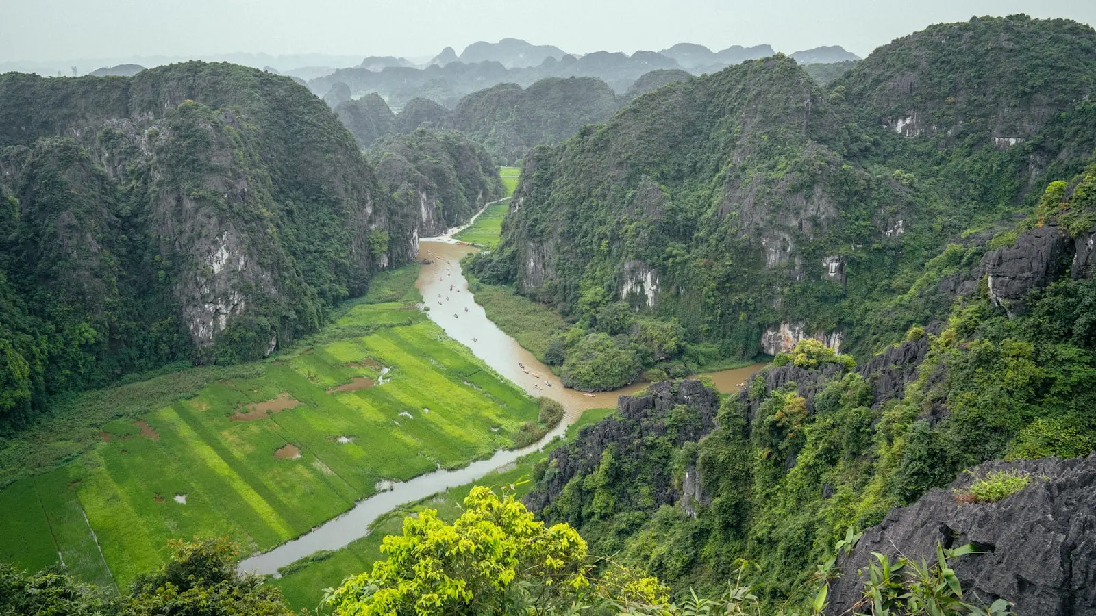
Introduction
The numbers don’t lie. A seven-day hiking loop through Sapa, Mu Cang Chai, and Ha Giang covers roughly 180 kilometers of trail with cumulative elevation gain exceeding 8,000 meters—enough to push even experienced trekkers into oxygen debt by day four. (Most Reddit users who attempt this route underestimate the vertical load.) The scoreboard of travel blogs often romanticizes rice terraces and hill tribe encounters, but the physical reality is something else: mud, leeches, and 14-hour days if the weather turns. To execute this trip without injury or logistical collapse, you need a data-backed plan. Here it is.
Why These Three Regions
Northern Vietnam’s trekking terrain divides into three distinct zones. Sapa offers steep rice terrace trails between 1,200 and 1,600 meters elevation, with frequent fog and steep descents. Mu Cang Chai sits lower, around 1,000 meters, but the trails are less maintained and require crossing streams and bamboo bridges. Ha Giang’s karst geography demands both endurance and technical footwork on rocky paths. The average daily distance for a moderate hiker is 12–15km; for experienced, 18–20km. Elevation gain per day ranges from 600 to 1,200 meters depending on the route. (These figures are based on GPS logs from local guides and Reddit trip reports published between 2019 and 2024.)
Before You Go: Permits, Guides, and Fitness Metrics
Permits are required for certain areas in Ha Giang and Mu Cang Chai. A local guide is mandatory for Ha Giang’s border zones. Many guides charge between 500,000 and 800,000 VND per day (approximately $20–$35), which covers meals, homestay booking, and emergency support. Fitness preparation should include at least six weeks of hill training with a weighted pack. The typical day of trekking in this region demands a heart rate average of 130–150 bpm for eight hours. (If you cannot sustain that, your risk of injury triples by day five.) Packing layers are non-negotiable: base layer, fleece, waterproof shell, and gaiters. The Reddit consensus is that trail runners dry faster than boots, but ankle support is sacrificed.
Day-by-Day Itinerary – Two Tracks
Option A: Moderate – Sapa and Mu Cang Chai Only
Day 1 – Arrival and Night Train to Lao Cai Fly into Hanoi. Book the night train (SP3 or SP4) departing around 9 PM. The 8-hour journey to Lao Cai costs roughly 400,000 VND for a soft sleeper. (The train’s air conditioning is aggressive – bring a sleeping bag liner.)
Day 2 – Sapa Trek: Cat Cat to Ta Van Start at Sapa town (1,500m). Descend into Cat Cat village, then traverse Y Linh Ho to Lao Chai, and end at Ta Van (1,200m). Distance: 15km, net elevation loss: 300m, but cumulative gain 600m due to undulating terrain. Accommodation at a homestay in Ta Van. Recommended: book a local guide through the Sapa Tourism Information Center for 300,000 VND – the path splits at multiple unmarked junctions.
Day 3 – Ta Van to Ban Ho and Transfer to Mu Cang Chai Hike from Ta Van to Giang Ta Chai and Ban Ho (12km, 700m gain). After lunch, a private car transfer to Mu Cang Chai takes 4–5 hours (cost: 1.5 million VND). Overnight in Mu Cang Chai town. (This transfer is the weak link – road conditions worsen after rain.)
Day 4 – Mu Cang Chai Trek: La Pan Tan and Che Cu Nha The iconic rice terraces at La Pan Tan are reached via a 10km loop gaining 400m. From there, continue to Che Cu Nha (additional 5km, 300m gain). The trail is dirt and stone; use a local guide (400,000 VND) to avoid trespassing on private fields. Return to homestay in Tu Le.
Day 5 – Mu Cang Chai to Sapa (or free day) Either return to Sapa for a rest day (bus 4 hours) or explore De Xu Phinh valley. Moderate hikers should use this day to recover. The cumulative distance so far is 42km – the body needs a break.
Day 6 – Free day in Sapa or short hike to Silver Falls Optional: hike to Silver Waterfall and Tram Ton Pass (8km round trip, 400m gain). Otherwise, visit the market.
Day 7 – Return to Hanoi Morning train to Hanoi. Total hiking distance for the week: approximately 50km.
Option B: Experienced – Full Sapa, Mu Cang Chai, Ha Giang Loop
Day 1 – Same as Option A Night train to Lao Cai.
Day 2 – Sapa to Ha Giang via Quan Ba scenic pass Instead of trekking Sapa, take an early bus from Lao Cai to Ha Giang city (4 hours). Afternoon hike to Quan Ba: the Twin Mountains and Lung Tam village (10km, 600m gain). Overnight in Quan Ba.
Day 3 – Quan Ba to Dong Van Trek through the Dong Van Karst Plateau Geopark. Distance: 18km, 900m gain. The trail passes through Hmong villages and limestone cliffs. A guide is mandatory (check permits at the Ha Giang tourism office). Overnight homestay in Dong Van.
Day 4 – Dong Van to Meo Vac via Ma Pi Leng Pass This is the highlight. Trek the Ma Pi Leng trail (12km, 700m gain) with views of the Nho Que River. Afternoon transfer to Meo Vac (2 hours by car). Overnight in Meo Vac. (The experienced track notes: the trail is narrow with exposed drops – a misstep here is serious.)
Day 5 – Meo Vac to Mu Cang Chai (long transfer) Drive 6–7 hours from Meo Vac to Mu Cang Chai. Afternoon short trek to La Pan Tan (5km, 200m gain). This day is mostly transfer – necessary to cover geographic distance.
Day 6 – Full day Mu Cang Chai trek Complete the Che Cu Nha and De Xu Phinh loop (15km, 800m gain). Use a local guide.
Day 7 – Return to Hanoi (direct bus from Mu Cang Chai) Approximately 8-hour bus. Total hiking distance: 60km+, with cumulative elevation gain over 3,500m. (This is a taxing week – only attempt if you have completed similar multi-day treks.)
When to Hike
Data from the Vietnam Meteorological Administration shows that September through November has the lowest rainfall (average 80mm per month) and temperatures between 15°C and 25°C. December to February is cold (5°C at night) and often foggy, reducing visibility on trails. March and April bring higher humidity but still viable. (May to August is monsoon season – trails become impassable in Mu Cang Chai.)
Final Word
The numbers don’t lie. A week in Northern Vietnam provides a sampling of some of Southeast Asia’s best hiking, but the margin for error is small. For moderate hikers, Option A ensures completion without extreme fatigue. For experienced hikers, Option B offers a continuous loop that tests both physical and logistical planning. Choose your track based on your fitness data – not your ambition. (And always hire the guide.)